
You’ve probably felt that sudden, bone-chilling blast that makes you question your life choices while walking along Croatia’s stunning coastline. That’s Bura greeting you with all the subtlety of a freight train, arriving without warning to remind everyone who’s really in charge. But there’s another player in this atmospheric drama—Jugo, the warm, brooding presence that builds tension like a master storyteller. These two winds don’t just move air; they shape entire lives, and their rivalry has consequences you’d never expect.
- Key Points
- The Birth of Bura: Cold Winds From the Dinaric Alps
- Understanding Jugo: The Warm Mediterranean Sirocco
- When Nature Unleashes Fury: Wind Speeds and Intensity
- Transportation Chaos: How These Winds Disrupt Travel
- Sailors Beware: Maritime Challenges and Hazards
- Seasonal Rhythms: When and Where the Winds Strike
- Winter Bura Intensity Peaks
- Southern Adriatic Jugo Dominance
- Regional Hotspots: Croatia’s Most Wind-Affected Areas
- Weather Patterns and Atmospheric Science Behind the Winds
- Cold Air Mass Descent
- Cyclonal Movement Systems
- Seasonal Atmospheric Pressure Changes
- From Boreas to Local Legend: Cultural Mythology and Folklore
- Living With the Winds: Local Wisdom and Survival Strategies
- The Last Word
Key Points
- Bura is a powerful northeasterly wind from the Dinaric Alps reaching speeds over 220 km/h, while Jugo is a warm southeastern wind.
- Bura arrives suddenly with hurricane-force gusts during winter, whereas Jugo builds gradually over 24 hours and lasts 3-5 days.
- These winds significantly impact daily life, requiring reinforced architecture, adjusted ferry schedules, and specialized clothing for locals.
- Bura originates from Greek mythology (Boreas) and follows a nine-day cycle: three days growing, flourishing, then fading.
- Key hotspots include Velebit Mountains for extreme Bura winds and Dubrovnik region as Jugo’s southern stronghold.
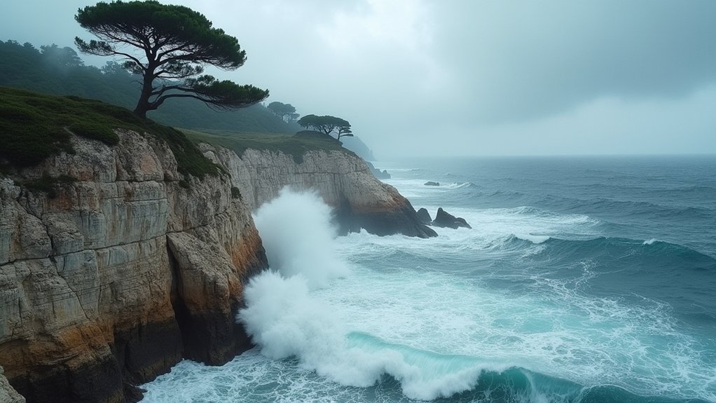
The Birth of Bura: Cold Winds From the Dinaric Alps

When cold continental air masses from Central Europe encounter the towering peaks of the Dinaric Alps, they don’t simply roll over them like a gentle breeze—they transform into one of the Mediterranean’s most formidable wind phenomena.
You’re witnessing the birth of the Bura, Croatia’s legendary northeasterly wind that’s both feared and revered along the Adriatic coast.
Picture this: frigid Russian air hovers among alpine peaks, cooling further before plunging dramatically toward the warmer Adriatic Sea below.
As these air masses funnel through mountain passes, they gain tremendous speed and strength, creating a wind so powerful it can reach hurricane-force intensities. In March 2015, the Bura demonstrated its raw power by reaching 103 mph speeds, equivalent to a Category 2 hurricane.
The stark temperature contrast between the cold mountain air and the Mediterranean’s warmth acts like nature’s turbocharger, transforming a simple breeze into a meteorological marvel.
Understanding Jugo: The Warm Mediterranean Sirocco
While the Bura charges down mountainsides like nature’s own freight train, its counterpart Jugo arrives with the patience of a Mediterranean sunset, bringing warm, humid air from the southeast that transforms Croatia’s coastline into something altogether different.
Like a patient giant awakening from slumber, Jugo transforms Croatia’s coastline with warm Mediterranean whispers.
You’ll notice Jugo’s gradual approach over 24 to 36 hours, building strength methodically rather than announcing itself with sudden fury. This sirocco variant creates a distinctly different coastal experience:
- Steady winds reaching 10-30 m/s with cloudy, rainy conditions
- Wave heights building gradually, often exceeding 5 meters in open waters
- Duration lasting 3-5 days, sometimes extending to three weeks
- Reduced visibility from accompanying fog and occasional Sahara dust
- Psychological effects including headaches and irritability among locals
You’ll find autumn Jugos particularly fierce, while summer episodes remain lighter and more manageable for coastal activities. The wind creates dangerous undertow conditions in harbors, making docking and anchoring particularly challenging for mariners even after the initial wind subsides.
When Nature Unleashes Fury: Wind Speeds and Intensity
Though Jugo may arrive like a patient giant, Bura strikes Croatia’s coastline with the raw power of a meteorological sledgehammer, releasing wind speeds that can humble even the most seasoned weather watchers.
You’ll witness gusts exceeding 220 km/h near the Velebit mountains, where extreme cases have reached a staggering 248 km/h—that’s enough force to uproot trees and send your patio furniture on an unscheduled flight.
The wind’s northeast origin funnels through mountain passes, creating hydraulic flow mechanisms that amplify its already formidable strength. This katabatic wind forms when cold, dry air masses accumulate over the highlands and descend rapidly due to pressure differences.
What makes Bura particularly treacherous is its sudden arrival with little warning, transforming calm coastal areas into wind-whipped battlegrounds within minutes, forcing ferries into port and making even seasoned sailors rethink their maritime adventures.
Transportation Chaos: How These Winds Disrupt Travel
As Croatia’s mighty winds transform from meteorological phenomena into transportation nightmares, you’ll discover that getting from point A to point B becomes an exercise in patience, planning, and sometimes pure luck.
When bura releases gusts exceeding 150 km/h, you’re not just facing delays—you’re confronting complete shutdowns of critical infrastructure.
These winds create widespread chaos across multiple transport modes:
- Ferry services cancel for hours or days, stranding passengers on islands
- The Pag bridge closes entirely during extreme bura episodes
- Highways near coastal areas implement sudden restrictions to prevent accidents
- Maritime traffic halts as captains refuse to risk dangerous crossings
- Bus schedules crumble when mountain roads become impassable
Croatia’s engineering marvels, like Pelješac Bridge with its towering windbreaks, fight back against nature’s fury, but sometimes even technology must yield. Engineers tested the bridge in an air tunnel to ensure it could withstand the relentless assault of these coastal winds.
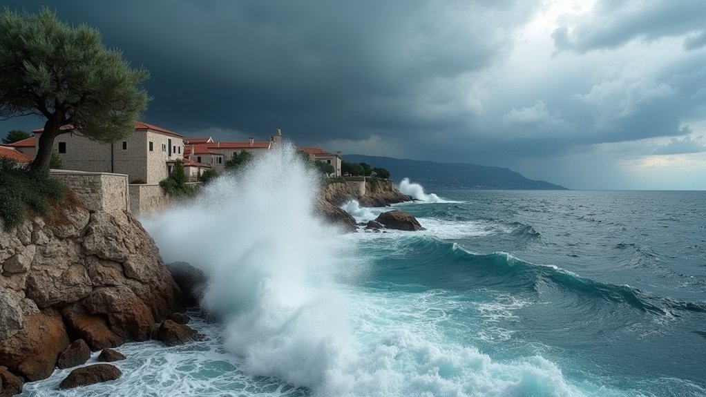
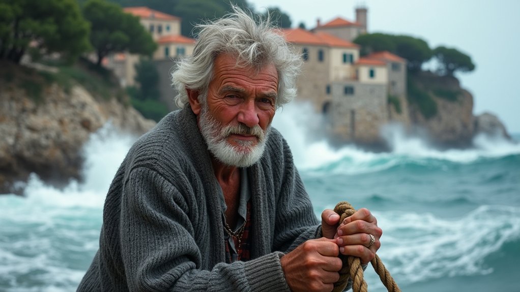
Sailors Beware: Maritime Challenges and Hazards
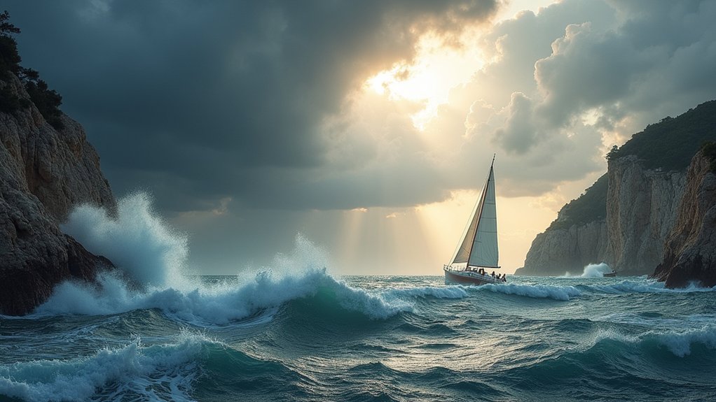
When Croatia’s notorious winds meet the Adriatic Sea, they transform peaceful waters into a sailor’s worst nightmare, creating conditions that can humble even the most experienced mariners.
Bura’s sudden gusts can reach 200 km/h, powerful enough to overturn boats and generate steep waves up to 2.5 meters that’ll challenge smaller vessels. The unpredictable nature of this wind makes it particularly hazardous, as sailors can be caught off guard without warning.
Bura’s ferocious 200 km/h gusts unleash chaos on the Adriatic, overturning vessels and spawning treacherous 2.5-meter waves that humble small boats.
Meanwhile, Jugo brings its own menace, lasting up to three weeks and producing towering 5-meter swells that test even larger ships’ stability.
Both winds create treacherous visibility conditions—Bura’s dry mist and Jugo’s foggy veil make navigation a guessing game.
Smart sailors seek shelter in protected areas like the leeward sides of Kornati or Mljet islands, while avoiding notorious danger zones such as the Velebit channel and Kvarner region during active wind periods.
Seasonal Rhythms: When and Where the Winds Strike
You’ll discover that Croatia’s winds follow nature’s calendar with remarkable precision, each claiming its own season and territory like feuding neighbors.
Winter transforms the Bura into a ferocious beast, releasing its most violent gusts across the eastern Adriatic coast when temperatures drop and atmospheric pressure systems intensify. These winter storms can persist for 3 to 7 days, making them endurance tests for both sailors and coastal communities.
Meanwhile, the southern Adriatic becomes Jugo‘s kingdom, where this steadier but equally formidable wind rules with particular authority from Dubrovnik to Boka Kotorska Bay, building its strength methodically over days rather than striking with Bura’s sudden fury.
Winter Bura Intensity Peaks
Every winter along Croatia’s stunning Adriatic coast, the bura transforms from a seasonal whisper into a meteorological monster, releasing its most ferocious displays when continental cold meets Mediterranean warmth.
You’ll witness this katabatic wind‘s peak fury from early autumn through late spring, with the strongest episodes lasting up to two weeks.
The bura’s intensity follows predictable patterns that’ll help you understand its behavior:
- Wind speeds reach force 7-9 on the Beaufort scale with violent “Reffoli” gusts
- Early evening hours bring the most intense blasts, while midday offers relative calm
- The Velebit Channel and Gulf of Trieste experience the most devastating impacts
- Cold, dry air creates choppy waves and reduces humidity dramatically
- Initial outbreak days pack the highest punch before gradually weakening
This northeasterly giant doesn’t just blow—it scours coastal areas with bone-chilling precision. The bura creates significant troubles for sailors who must navigate these treacherous conditions, making maritime activities extremely hazardous during peak intensity periods.
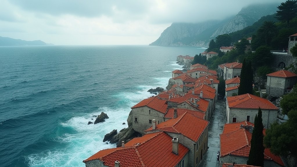
Southern Adriatic Jugo Dominance
While the bura commands attention with its winter theatrics in the north, the southern Adriatic tells a completely different story where jugo reigns supreme as the region’s meteorological monarch.
You’ll discover this warm, moist wind holding court from Dubrovnik to Boka Kotorska Bay, flexing its muscles most impressively during autumn and spring shifts. Unlike bura’s sudden tantrums, jugo builds gradually over 24 hours, then settles in for extended stays that can stretch up to three weeks with minor breaks.
The southern waters experience jugo’s full intensity, generating waves exceeding five meters in open seas. While northern ports enjoy natural shelter from coastal topography, southern coastlines face jugo’s unfiltered power, making this warm wind the undisputed ruler of Croatia’s southern maritime domain. Mariners can rely on jugo’s predictable nature, as this powerful wind system telegraphs its movements through consistent barometric pressure changes, unlike the chaotic gusts of its northern counterpart.
Regional Hotspots: Croatia’s Most Wind-Affected Areas
Croatia’s rugged geography creates distinct wind corridors where nature releases some of Europe’s most dramatic atmospheric performances.
You’ll discover these regional hotspots scattered along the coast, each with its own meteorological personality that’ll either thrill or terrify you.
Croatia’s Top Wind Hotspots:
- Velebit Mountain Range – The bora’s birthplace, where Senj and Karlobag face bone-rattling gusts up to 220 km/h
- Maslenica Bridge Area – Record-breaking 248 km/h winds that’ll make your car feel like a toy
- Central Adriatic Islands – Maestral winds create sailing paradise between Brač and Pelješac channels
- Dubrovnik Region – Jugo’s southern stronghold brings warm, stormy conditions lasting days
- Split Coastal Zone – Tramontana’s sudden northern strikes shift dramatically into powerful bora events
These wind corridors showcase Croatia’s position between continental and Mediterranean climates, creating unforgettable atmospheric drama. The most extreme bora events can maintain their intensity for 67-68 hours straight, creating marathon-like endurance tests for coastal communities.
Weather Patterns and Atmospheric Science Behind the Winds
When you witness Bura’s ferocious gusts tearing down the Velebit slopes at 200+ km/h, you’re actually seeing a massive cold air mass plummeting from the continental interior like an invisible avalanche, driven by stark pressure differences between the chilled landmass and Croatia’s warmer Adriatic waters.
Meanwhile, Jugo operates through an entirely different atmospheric playbook, riding cyclonal systems that sweep warm, moisture-laden air from the Sahara and Mediterranean northward into the Balkans, creating those persistent, muggy conditions that make locals reach for their fans.
These contrasting wind patterns follow predictable seasonal rhythms—Bura dominating winter months when continental cooling peaks, while Jugo flexes its muscles during changing seasons when shifting pressure systems dance across Southern Europe like meteorological chess pieces. The Bura’s intensity actually increases at night as the mountain air cools further and becomes even more dense, creating an accelerating effect that catches many visitors off guard.
Cold Air Mass Descent
As cold air masses gather strength above the towering Dinaric Alps, they’re setting the stage for one of nature’s most dramatic meteorological performances along Croatia’s coast.
When these dense, chilly air masses begin their gravity-driven descent, they’re transforming into the legendary Bura wind that Croatia’s coastal residents know all too well.
You’ll witness this atmospheric phenomenon as cold air rushes downhill, compressing and accelerating through mountain passes like water through a funnel.
The mechanics are surprisingly straightforward yet powerfully effective:
- Cold air masses descend from elevated Dinaric terrain toward the warmer Adriatic Sea
- Gravity pulls the denser, heavier cold air downslope at increasing speeds
- Compression occurs as air accelerates, creating sudden gusts up to 200 km/h
- Temperature differences between land and sea amplify the wind’s intensity
- Dry air conditions produce crystal-clear visibility during Bura events
This powerful wind system typically maintains its intensity for about three days, creating sustained periods of challenging weather conditions that coastal communities must endure.
Cyclonal Movement Systems
While Bura winds dramatically showcase the power of descending cold air masses, the equally formidable Jugo winds tell a completely different atmospheric story—one driven by the sweeping dance of cyclonal systems across the Mediterranean basin.
You’ll witness these low-pressure systems generating moist southerly airflow that brings heavy clouds and prolonged rainfall to Croatia’s coast. As cyclones develop, you’ll notice falling air pressure, building cloud bases, and strengthening currents that signal Jugo’s approach.
During autumn, these cyclonal juggernauts intensify dramatically, producing winds up to 50 knots and towering waves reaching five meters high. Unlike their cold, dry Bura counterparts, cyclonal Jugos deliver wetter, stormier conditions that can persist for several days, transforming both maritime and coastal environments. These powerful systems develop slowly over time, typically lasting 5-6 days as they track across the region.
Seasonal Atmospheric Pressure Changes
Croatia’s atmospheric pressure systems operate on nature’s own seasonal schedule, creating distinct windows of opportunity for both Bura and Jugo winds throughout the year.
You’ll notice these pressure changes follow predictable patterns, with each wind bringing its own atmospheric signature that savvy locals have learned to read like a weather almanac.
Understanding these seasonal changes helps you anticipate when each wind will make its dramatic entrance:
- Winter dominance: Bura rules October through April with sudden pressure gradients, while Jugo builds gradually with dropping pressure
- Summer brevity: Bura appears for mere hours, Jugo becomes lighter and sailing-friendly
- Autumn intensity: Jugo peaks with 2-3 day buildups, creating massive pressure drops
- Spring shifts: Both winds compete as pressure systems shift across the Mediterranean
- Pressure signals: Falling barometers herald Jugo’s warm moisture, rising pressure announces Bura’s cold, dry arrival
The contrast between these winds becomes especially pronounced during their peak seasons, as Bura’s katabatic nature sends it cascading down coastal mountain slopes with violent force, while Jugo’s gradual buildup from the southeast creates entirely different sailing conditions.
From Boreas to Local Legend: Cultural Mythology and Folklore
Deep within the windswept legends of the Adriatic coast, the mighty Bura carries more than just frigid air and crystalline skies—it bears the ancient echoes of Greek mythology itself.
You’ll discover that Bura’s name traces back to Boreas, the fierce Greek god of the north wind, whose violent kidnapping of the princess Orithyia perfectly captures this tempestuous force’s unpredictable nature.
Croatian folklore has woven its own enchanting tales around this powerful wind. You might hear locals speak of a girl named Bura who strikes back when cursed, embodying the wind’s retributive spirit.
There’s even a charming belief that three March Buras promise a glorious summer ahead, while legends describe the wind’s poetic lifecycle: three days to grow, three days to flourish, and three days to fade away. This legendary wind descends from the Velebit mountain range, bringing its fierce northern breath to the coastal communities below.
Living With the Winds: Local Wisdom and Survival Strategies
Along the rugged Adriatic coastline, generations of Croatians have transformed the challenge of living with Bura and Jugo into an art form of resilience and adaptation.
You’ll discover their survival strategies woven into every aspect of daily life, from reinforced rooftops to perfectly timed ferry schedules.
Their time-tested wisdom includes:
- Timing outdoor activities around sudden Bura gusts that can reach 220 km/h
- Strategic clothing choices – windproof layers for Bura, water-resistant gear for Jugo
- Agricultural planning with wind-tolerant crops and strategic windbreaks
- Maritime navigation using traditional knowledge and modern forecasts
- Health practices incorporating community remedies for wind-related stress
These locals don’t just endure nature’s fury—they’ve mastered it, turning meteorological challenges into opportunities for ingenious adaptation. Experienced fishermen and sailors particularly understand that recognizing wind calms can be crucial for survival, as these deceptively peaceful periods often signal the approach of sudden, dangerous storms.
The Last Word
You’ve witnessed how Bura’s icy fury and Jugo’s humid embrace shape Croatia’s coastal identity, transforming mere weather into cultural force. These aren’t just meteorological phenomena—they’re the invisible architects of Adriatic life, demanding respect from sailors, travelers, and locals alike. As you plan your Croatian adventure, remember: you can’t control these ancient winds, but you can learn their rhythms. Understanding Bura and Jugo isn’t just weather wisdom—it’s your key to truly experiencing Croatia’s wild, windswept soul.